Envis Centre, Ministry of Environment & Forest, Govt. of India
Printed Date: Wednesday, April 24, 2024
About Kerala (OLD)
Kerala, the southern most State of India lies in between 8°18' and 12°48' latitude and 74°52' and 72°22' longitude. The total geographic area of the State is 38,86,300 ha. To its east and north-east, Kerala borders Tamil Nadu and Karnataka; to its west lies the Arabian Sea and to its south the Indian Ocean islands of Lakshadweep and the Maldives, respectively.
After India's independence in 1947, Travancore and Cochin were merged to form Travancore-Cochin on July 1, 1949. Later, the Government of India's November 1,1956 States Reorganisation Act inaugurated a new state-Kerala-incorporating Malabar District, Travancore-Cochin, and the Taluk of Kasaragod, South Kanara. A new Legislative Assembly was also created, for which elections were held in 1957.
State Symbols
|
|
|
|
|
|
|
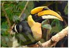
State bird
Great Indian hornbill
|
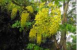
State Flower
Golden shower
|
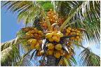
State tree
Cocunut tree
|
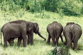
State animal
Elephant
|
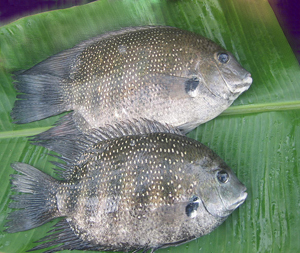
State fish
Pearl spot
|